Publication Now Online! Public Health Co-benefits to reducing GHGs

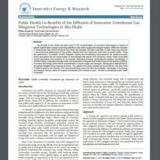
Very happy to have our PIs from CCRG and NCAR have our study “Public Health Co-Benefits of the Diffusion of Innovative Greenhouse Gas Mitigation Technologies in Abu Dhabi” be published!

It can be downloaded at: https://www.omicsonline.org/open-access/public-health-cobenefits-of-the-diffusion-of-innovative-greenhouse-gasmitigation-technologies-in-abu-dhabi.php?aid=94601

Abstract
The emirate of Abu Dhabi has been active in the implementation of innovative technologies to reduce its carbon footprint from energy consuming activities in the power supply and transport sectors. While the reduction in GreenHouse Gas (GHG) emissions from these technologies has been quantified, to date, there has not been a comprehensive assessment of the positive impacts that such measures could have on public health. These are considered a “co-benefit” of GHG mitigation, namely the simultaneous improvement in air quality and public health associated with the dissemination of technologies that reduce GHG emissions. Public health co-benefits include reductions in the incidence of, for example, respiratory illnesses, cardiovascular disease, and allergies. A scenario-based, integrated damage model was developed to integrate local meteorology and air quality conditions, innovative technology performance characteristics in power supply and transport, demographic features/trends, and epidemiological dose-response functions. The results of the study indicate that future efforts in the Abu Dhabi Emirate to expand and intensify GHG-reducing activities using innovative technologies – particularly in the energy and transport sectors where the majority of potential GHG reductions exist – will lead to substantial public health co-benefit

Make sure to also check out our Online Toolkit for the project where you can view and download the models and data at https://www.ccr-group.org/health-co-benefits

Newest Eye on Earth Webinar Announced for February 7th 2018!

JOIN US FOR A WEBINAR ON TUE FEB 07, 2018 AT 12:00 PM UTC   DURATION 1 HOUR.


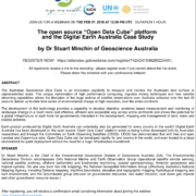
The open source “Open Data Cube” platform
and the Digital Earth Australia Case Study


by Dr Stuart Minchin of Geoscience Australia


REGISTER NOW!   HTTPS://ATTENDEE.GOTOWEBINAR.COM/REGISTER/7424241548289224451 


  • All registrants receive a link to the recording – please register even if you cannot attend the live event.
  • Please share this invitation with your professional network

ABSTRACT

The Australian Geoscience Data Cube is an innovative capability to measure and monitor the Australian land surface at unprecedented scale. The unique combination of high performance computing, big-data mining techniques and new satellite observing capabilities allows the liberation of the huge archive of satellite observations over Australia collected over the last 35 years to deliver up-to-date time series of environmental change at high resolution, over the entire continent.

The development of this technology provides a capability to develop objective, evidence based measurement and monitoring of landscape change in a much more cost effective, efficient and accessible way across entire continents and shows the potential for a global infrastructure of such tools for governments interested in the development, mapping and management of land, water and coastal activities.

Each product produced by Digital Earth Australia can potentially also be generated for every country in the world!! Digital Earth Australia has been developed on the open source “Open Data Cube” platform which is being further developed both by Australian researchers and through the Committee on Earth Observing Satellites (CEOS). CEOS has demonstrated that with free and open Landsat and Copernicus data, Open Data Cube can be developed rapidly for any country in the world, and even hosted in a cloud environment for quick deployment without the need for a huge infrastructure investment.

SPEAKER

Dr Stuart Minchin is the Chief of the Environmental Geoscience Division of Geoscience Australia (GA). The Environmental Geoscience Division encompasses GA’s National Marine and Earth Observation Group (operational satellite remote sensing, national satellite archives, offshore bathymetry and biodiversity monitoring, coastal geomorphology, Antarctic geoscience and tropical cyclone, fire and sea level rise risk mapping), the National Geospatial Information Group (effectively Australia’s National Mapping Agency, including Defence mapping, maritime boundaries, elevation and topographic mapping, hydrological mapping and built environment), and the Groundwater group (focused on groundwater resources, sea water intrusion, coal seam gas impacts and other groundwater resource issues.)


After registering, you will receive a confirmation email containing information about joining the webinar.

View System Requirements

Accelerated Deployment of IRIS in 2018

Following a very successful launch on 2 December 2017, the Indicator Reporting Information System (IRIS), is gearing up for an accelerated deployment in 2018.  Indeed, Phase III of the “Capacity Building Programme on Environment Statistics in Africa” will start later this month; a group of selected pilot countries (Burkina Faso, Cameroon, Equatorial Guinea, Ghana, The Gambia, Malawi, Namibia and Senegal) will conduct national workshops and receive technical assistance. A substantial number of activities are planned to be carried out, one of them includes setting up IRIS database and provide guidance on using IRIS for data storage. Click on the following link for more details: https://unstats.un.org/unsd/environment/envpdf/Issue42.pdf.

Both the Environment Agency – Abu Dhabi (EAD) and UN Environment look forward to working at a sub-national and regional level to deploy IRIS globally.

Latest Eye on Earth Webinar Recording now available online

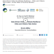
Happy to share that our last webinar by Ecocity Builders on Data Driven Cities for Climate Resilience is now available online incase that you missed it on our webinar page

According to UN Habitat the effects of urbanization and climate change are converging: cities cover less than 2% of the earth’s surface, use 78% of world energy, and produce 60% of CO2 and GHGs through energy generation, transportation, industry and biomass use. Cities and towns are also very vulnerable to climate change and the most affected populations are the urban poor. Habitat goes on to say that cities can reduce GHG emissions while addressing other local environmental problems such as air pollution, waste disposal, and transportation. The challenge is to link climate change to local environmental and development priorities. This webinar will showcase how data and associated mapping technologies can support the creation of sustainable cities resilient to the impacts of climate change. This is accomplished both by providing formats that integrate environmental, social and economic data for an urban area and its surrounding region, and by providing a common visual language that will facilitate discussion between local stakeholders and government agencies.

Kirstin Miller is Executive Director of San Francisco Bay Area based Ecocity Builders.

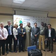
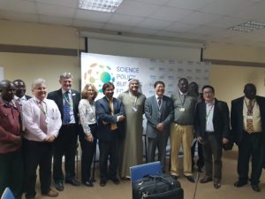
AGEDI launches the Indicator Reporting Information System (IRIS) at the UN Global Science-Policy-Business Forum on the Environment in Nairobi, Kenya

IRIS News Clippings (5846 downloads )

Abu Dhabi, UAE: 20 December 2017: Following a successful collaboration between Environment Agency – Abu Dhabi (EAD) and UN Environment, the Abu Dhabi Global Environmental Data Initiative (AGEDI) launched the Indicator Reporting Information System (IRIS) during the UN Global Science-Policy-Business Forum on the Environment that took place during the third session of the UN Environment Assembly held in Nairobi, Kenya between 4-6 December 2017.

IRIS is an enterprise web application intended for organizations involved in regular environmental status and performance reporting. It is a targeted response to a set of widespread, real world challenges faced by many organizations across the world. Its main aims are to reduce the institutional burden associated with recurring report production and to   provide timelier and more complete information for decision makers; in all tiers of Governance – local to global develop; to develop institutional capacity; and be a practical, durable and globally applicable solution.

Ahmed Baharoon, AGEDI’s Acting Director said: “We are very proud to be able to show our stakeholders the result of the hard work between the AGEDI implementation partners to reach the point where IRIS is ready to be launched. We look forward to collaborating with UN Environment even closer in 2018 to deliver IRIS to its users”.

The path forward includes further strengthening the software to ensure its long-term durability; a regional capacity-building workshop for West Asia will be held in Abu Dhabi in Q2 of 2018, as well as the deployment of IRIS in a first batch of interested countries from across the globe. “We look at 2018 with great excitement and anticipation; a substantial number of countries have expressed interest to have the IRIS deployed within their ministries or institutions responsible for environmental reporting. UN Environment will strive to meet this demand and to demonstrate the significant value add that IRIS represents in the global reporting ecosystem.” said Dr. Jian Liu, Chief Scientist at UN Environment.

More information on IRIS can be found at www.agedi.org/iris and www.environmentlive.unep.org/myiris. Queries can be sent to [email protected].


أجيدي تطلق مؤشر نظام معلومات التقارير في منتدى العلوم والسياسات والأعمال أثناء اجتماع جمعية الأمم المتحدة للبيئة في نيروبي

أبوظبي، الإمارات العربية المتحدة: 20 ديسمبر، 2017: استمراراً للتعاون الناجح بين هيئة البيئة – أبوظبي وبرنامج الأمم المتحدة للبيئة، أطلقت المبادرة العالمية للبيانات البيئية (أجيدي) مؤشر نظام معلومات التقارير خلال منتدى العلم والسياسات العامة والأعمال الذي عقد كحدث جانبي على هامش الدورة الثالثة لجمعية الأمم المتحدة للبيئة التابعة لبرنامج الأمم المتحدة للبيئة في مقر برنامج الأمم المتحدة للبيئة في نيروبي، خلال الفترة من 4 إلى 6 ديسمبر 2017.

ومؤشر نظام معلومات التقارير هو تطبيق إلكتروني مخصص للمؤسسات التي تقدم تقارير دورية حول حالة البيئة وأدائها، كما أنه يعتبر استجابة مستهدفة لمجموعة واسعة من التحديات العالمية الحقيقية. وتتمثل أهداف هذا المؤشر في تقليل العبء المؤسسي المرتبط بإعداد التقارير بشكل متكرر، وتقديم معلومات موثوقة وفي الوقت المناسب لصناع القرار، على كافة مستويات الحوكمة – المحلية والدولية، كما يهدف إلى تعزيز القدرات المؤسسية، لتصبح حلاً عمليا ومستقراً وقابل للتطبيق عالمياً.

وقال أحمد باهارون، مدير مبادرة أبوظبي العالمية للبيانات البيئية بالإنابة: “من دواعي سرورنا وفخرنا أننا تمكننا من إطلاع شركائنا على نتائج الجهود الدؤوبة التي بذلتها مبادرة أبوظبي العالمية للبيانات البيئية، بالتعاون مع شركائنا التنفيذيين للوصول إلى مرحلة إطلاق مؤشر نظام معلومات التقارير. ونحن نتطلع إلى تعزيز التعاون مع جمعية الأمم المتحدة للبيئة في عام 2018 ليصل مؤشر نظام معلومات التقارير إلى مستخدميها”.

وتتضمن الخطط المستقبلية تحسين هذا التطبيق لضمان استمراره على المدى الطويل، كما أنه من المقرر أن تستضيف إمارة أبوظبي ورشة عمل إقليمية لبناء القدرات في منطقة غرب آسيا، وذلك في الربع الثاني من عام 2018. بالإضافة إلى تطوير مؤشر نظام معلومات التقارير في أول مجموعة من الدول المعنية من جميع أنحاء العالم.

وفي هذا الصدد قال د. جيان ليو كبير علماء البيئة في الأمم المتحدة: ” نتطلع بشغف إلى عام 2018، حيث عبر عدد كبير من الدول عن اهتمامهم ببرنامج مؤشر نظام معلومات التقارير من خلال وزاراتهم أو مؤسساتهم المسؤولة عن التقارير البيئية. وستسعى الأمم المتحدة للبيئة إلى تلبية طلباتهم، وتوضيح القيمة الكبيرة التي يضيفها مؤشر نظام معلومات التقارير لأنظمة التقارير حول العالم.”

للمزيد من المعلومات حول مؤشر نظام معلومات التقارير، يمكنكم زيارة الموقع الإلكتروني www.agedi.org/iris و الموقع www.environmentlive.unep.org/myiris، كما يمكنكم التواصل للاستفسار عبر البريد الإلكتروني [email protected].


Revamped Eye on Earth Website Now Online!

The Eye on Earth Network Coordination Unit (NCU), which AGEDI is part of, is pleased to announce that the revamped Eye on Earth website is now online at www.eye-on-earth.net!

The new website gives the user an insight into the three Focal Areas that now define Eye on Earth’s scope of activities; one can also view upcoming as well as previous webinars. The site will be continuously updated to better reflect the Eye on Earth movement as it stands today. Come take a look!


Come Join us at the next Emirate Natural History Group Talk

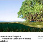
We are very privileged to be the next presenters at the Emirate Natural History Group (ENHG) where we will be presenting “Coastal Systems Protecting our Shorelines…from Blue Carbon to Climate Change Adaptation”

Come Join Us!

7pm October 10th, Park Hyatt Abu Dhabi

To Register and for more information:

https://enhgauh.tidyhq.com/public/schedule/events/16375-coastal-systems-protecting-our-shorelines-from-blue-carbon-to-climate-change-adaptation

360 Support of the GEF Blue Forests Meeting

AGEDI’s participation within the GEF Blue Forests Project as an intervention site is exciting and a crucial platform for sharing the lessons that we learn here in the UAE towards Blue Carbon and Ecosystem Services.

We were therefore pleased to support the GEF Blue Forest Regional Meeting recently held in Panama. We provided 360 videos of their meeting as well as kayaking through the beautiful mangroves of Bocas Del Toro.

Check it out here!